Submerged Archaeology
The Drowned Villages of the Scheldt project explores a remarkable yet vulnerable landscape in the Eastern Scheldt estuary. Hidden beneath the tidal flats lie the remains of late medieval villages that once thrived on reclaimed land. These villages, now submerged, offer unique time capsules that provide insight into how people lived with and shaped a dynamic coastal environment.
Today, the combination of rising sea levels, increased erosion, and changing sediment dynamics puts these archaeological sites at risk. This project investigates these landscapes before they disappear.
The project is part of the WEAVE programme, a European research collaboration framework in which the Universities of Ghent, Kiel and Vienna jointly applied for research funding. The project is funded by the Research Foundation – Flanders (FWO), the German Research Foundation (DFG), and the Austrian Science Fund (FWF).

Our Research Objectives
1. Reconstruct lost villages
We study the layout and structure of medieval villages Tolsende and Nieuwlande. This includes mapping buildings, roads, farmland, water management and dike systems.
2. Understand why they drowned
We examine both natural and human factors, such as storm surges, peat extraction, and changing hydrology, to explain how these areas were flooded.
3. Monitor underwater heritage
We test and develop tools for documenting and preserving drowned landscapes in tidal and underwater zones, using non-invasive methods.

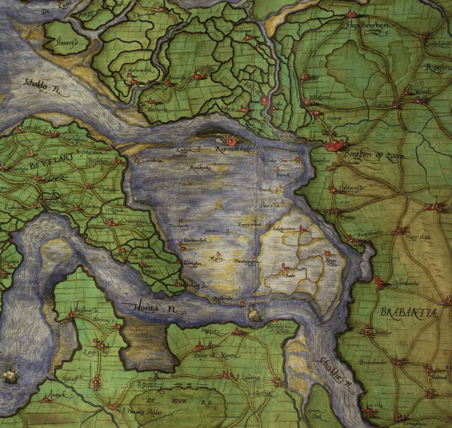
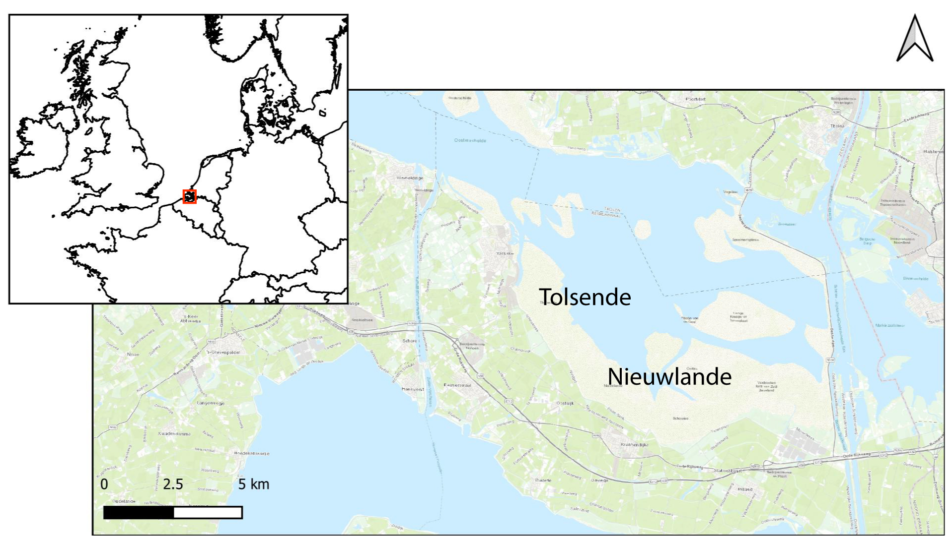
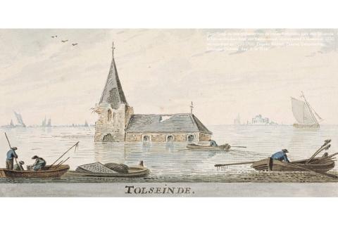
Case Study Sites: Tolsende & Nieuwlande
Our case study focuses on two lost villages located southeast of Yerseke. Tolsende and Nieuwlande emerged in the twelfth century during a period of intense land reclamation. After devastating floods in 1530 and 1532, both settlements were gradually abandoned and submerged.
Some of the remains of houses, streets, and agricultural fields are still visible during low tide. However, due to the changing regional water management from the late 20th century (Deltawerken), erosion has increased more rapidly than expected. Without intervention, much of the archaeological record could be lost by 2050.

A disappearing archive of landscape and memory
The Scheldt estuary contains over 200 drowned settlements. Studying these places helps us understand how past communities adapted to environmental change. It also reveals patterns of settlement, land use, and resilience that are relevant today.
This research contributes to heritage management, landscape planning, and international policy on underwater archaeology. By making these invisible places visible again, we reconnect people with their coastal past.